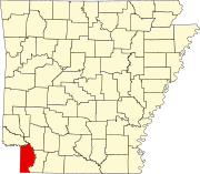
List of lakes of Miller County, Arkansas
Map all coordinates using OpenStreetMap
Download coordinates as:
- KML
- GPX (all coordinates)
- GPX (primary coordinates)
- GPX (secondary coordinates)
There are at least 63 named lakes and reservoirs in Miller County, Arkansas.
Lakes
- Adams Cut-off Lake, 33°35′05″N 093°51′35″W / 33.58472°N 93.85972°W / 33.58472; -93.85972 (Adams Cut-off Lake), el. 253 feet (77 m)[1]
- Alligator Lake, 33°15′53″N 094°01′32″W / 33.26472°N 94.02556°W / 33.26472; -94.02556 (Alligator Lake), el. 200 feet (61 m)[2]
- Candler Lake, 33°18′34″N 093°42′19″W / 33.30944°N 93.70528°W / 33.30944; -93.70528 (Candler Lake), el. 217 feet (66 m)[3]
- Clark Lake, 33°30′03″N 093°57′01″W / 33.50083°N 93.95028°W / 33.50083; -93.95028 (Clark Lake), el. 259 feet (79 m)[4]
- Clear Lake, 33°30′25″N 093°55′53″W / 33.50694°N 93.93139°W / 33.50694; -93.93139 (Clear Lake), el. 256 feet (78 m)[5]
- Cypress City Lake, 33°22′24″N 093°42′51″W / 33.37333°N 93.71417°W / 33.37333; -93.71417 (Cypress City Lake), el. 213 feet (65 m)[6]
- Cypress Lake, 33°20′01″N 093°42′33″W / 33.33361°N 93.70917°W / 33.33361; -93.70917 (Cypress Lake), el. 220 feet (67 m)[7]
- Elliott Slough, 33°16′01″N 094°01′03″W / 33.26694°N 94.01750°W / 33.26694; -94.01750 (Elliott Slough), el. 200 feet (61 m)[8]
- First Old River Lake, 33°29′55″N 093°46′04″W / 33.49861°N 93.76778°W / 33.49861; -93.76778 (First Old River Lake), el. 233 feet (71 m)[9]
- Fish Lake, 33°16′39″N 093°47′04″W / 33.27750°N 93.78444°W / 33.27750; -93.78444 (Fish Lake), el. 210 feet (64 m)[10]
- Ford Slough, 33°15′19″N 094°00′15″W / 33.25528°N 94.00417°W / 33.25528; -94.00417 (Ford Slough), el. 200 feet (61 m)[11]
- Goose Lake, 33°12′07″N 093°45′05″W / 33.20194°N 93.75139°W / 33.20194; -93.75139 (Goose Lake), el. 210 feet (64 m)[12]
- Haley Lake, 33°10′01″N 093°46′50″W / 33.16694°N 93.78056°W / 33.16694; -93.78056 (Haley Lake), el. 200 feet (61 m)[13]
- Harper Lake, 33°32′52″N 093°52′56″W / 33.54778°N 93.88222°W / 33.54778; -93.88222 (Harper Lake), el. 259 feet (79 m)[14]
- Keller Lake, 33°18′06″N 093°43′06″W / 33.30167°N 93.71833°W / 33.30167; -93.71833 (Keller Lake), el. 213 feet (65 m)[15]
- Kennedy Lake, 33°07′43″N 093°53′19″W / 33.12861°N 93.88861°W / 33.12861; -93.88861 (Kennedy Lake), el. 203 feet (62 m)[16]
- Kuykendall Lake, 33°33′21″N 093°49′58″W / 33.55583°N 93.83278°W / 33.55583; -93.83278 (Kuykendall Lake), el. 246 feet (75 m)[17]
- Little Pond, 33°12′13″N 093°56′54″W / 33.20361°N 93.94833°W / 33.20361; -93.94833 (Little Pond), el. 194 feet (59 m)[18]
- Long Slough, 33°14′54″N 094°01′19″W / 33.24833°N 94.02194°W / 33.24833; -94.02194 (Long Slough), el. 200 feet (61 m)[19]
- Mathis Slough, 33°16′32″N 094°02′00″W / 33.27556°N 94.03333°W / 33.27556; -94.03333 (Mathis Slough), el. 200 feet (61 m)[20]
- Mercer Lake, 33°08′49″N 093°54′10″W / 33.14694°N 93.90278°W / 33.14694; -93.90278 (Mercer Lake), el. 197 feet (60 m)[21]
- Moes Slough, 33°15′49″N 094°00′34″W / 33.26361°N 94.00944°W / 33.26361; -94.00944 (Moes Slough), el. 200 feet (61 m)[22]
- Nineteen hundred and forty Cut-off Lake, 33°31′24″N 093°44′39″W / 33.52333°N 93.74417°W / 33.52333; -93.74417 (Nineteen hundred and forty Cut-off Lake), el. 226 feet (69 m)[23]
- Palmer Lake, 33°02′33″N 093°50′27″W / 33.04250°N 93.84083°W / 33.04250; -93.84083 (Palmer Lake), el. 197 feet (60 m)[24]
- Pinhook Lake, 33°15′36″N 094°01′44″W / 33.26000°N 94.02889°W / 33.26000; -94.02889 (Pinhook Lake), el. 200 feet (61 m)[25]
- Red Lake, 33°27′41″N 093°44′57″W / 33.46139°N 93.74917°W / 33.46139; -93.74917 (Red Lake), el. 230 feet (70 m)[26]
- Scott Lake, 33°34′08″N 093°50′01″W / 33.56889°N 93.83361°W / 33.56889; -93.83361 (Scott Lake), el. 236 feet (72 m)[27]
- Second Old River Lake, 33°28′36″N 093°44′54″W / 33.47667°N 93.74833°W / 33.47667; -93.74833 (Second Old River Lake), el. 226 feet (69 m)[28]
- Snaggy Lake, 33°15′40″N 094°01′02″W / 33.26111°N 94.01722°W / 33.26111; -94.01722 (Snaggy Lake), el. 200 feet (61 m)[29]
- Snake Lake, 33°15′15″N 093°59′06″W / 33.25417°N 93.98500°W / 33.25417; -93.98500 (Snake Lake), el. 197 feet (60 m)[30]
- Tobe Lake, 33°34′39″N 093°52′53″W / 33.57750°N 93.88139°W / 33.57750; -93.88139 (Tobe Lake), el. 253 feet (77 m)[31]
- Whites Camp Lake, 33°17′10″N 094°00′17″W / 33.28611°N 94.00472°W / 33.28611; -94.00472 (Whites Camp Lake), el. 243 feet (74 m)[32]
- Willow Lake, 33°32′51″N 093°49′09″W / 33.54750°N 93.81917°W / 33.54750; -93.81917 (Willow Lake), el. 239 feet (73 m)[33]
- Winham Lake, 33°32′42″N 094°01′41″W / 33.54500°N 94.02806°W / 33.54500; -94.02806 (Winham Lake), el. 266 feet (81 m)[34]
Reservoirs
- Arkla Lake, 33°01′24″N 093°58′17″W / 33.02333°N 93.97139°W / 33.02333; -93.97139 (Arkla Lake), el. 253 feet (77 m)[35]
- Boyce Lake, 33°23′28″N 093°55′54″W / 33.39111°N 93.93167°W / 33.39111; -93.93167 (Boyce Lake), el. 312 feet (95 m)[36]
- Browns Lake, 33°17′12″N 094°00′43″W / 33.28667°N 94.01194°W / 33.28667; -94.01194 (Browns Lake), el. 236 feet (72 m)[37]
- Buford Lake, 33°29′01″N 093°57′20″W / 33.48361°N 93.95556°W / 33.48361; -93.95556 (Buford Lake), el. 302 feet (92 m)[38]
- Coca Cola Lake, 33°24′08″N 093°55′50″W / 33.40222°N 93.93056°W / 33.40222; -93.93056 (Coca Cola Lake), el. 308 feet (94 m)[39]
- Country Club, 33°24′17″N 094°01′20″W / 33.40472°N 94.02222°W / 33.40472; -94.02222 (Country Club Lake), el. 315 feet (96 m)[40]
- Cox Lake, 33°29′28″N 093°57′02″W / 33.49111°N 93.95056°W / 33.49111; -93.95056 (Cox Lake), el. 279 feet (85 m)[41]
- Crabtree Lake, 33°14′55″N 093°57′24″W / 33.24861°N 93.95667°W / 33.24861; -93.95667 (Crabtree Lake), el. 203 feet (62 m)[42]
- Davis Lake, 33°19′34″N 093°58′41″W / 33.32611°N 93.97806°W / 33.32611; -93.97806 (Davis Lake), el. 246 feet (75 m)[43]
- Davis Lake Number Two, 33°19′48″N 093°59′08″W / 33.33000°N 93.98556°W / 33.33000; -93.98556 (Davis Lake Number Two), el. 233 feet (71 m)[44]
- Eason Lake, 33°02′44″N 093°53′35″W / 33.04556°N 93.89306°W / 33.04556; -93.89306 (Eason Lake), el. 213 feet (65 m)[45]
- Gill Lake, 33°26′31″N 093°55′33″W / 33.44194°N 93.92583°W / 33.44194; -93.92583 (Gill Lake), el. 295 feet (90 m)[46]
- Hensley Lake, 33°20′27″N 093°47′03″W / 33.34083°N 93.78417°W / 33.34083; -93.78417 (Hensley Lake), el. 243 feet (74 m)[47]
- Jones Lake, 33°04′15″N 093°54′54″W / 33.07083°N 93.91500°W / 33.07083; -93.91500 (Jones Lake), el. 256 feet (78 m)[48]
- Lower Lake, 33°18′12″N 093°59′31″W / 33.30333°N 93.99194°W / 33.30333; -93.99194 (Lower Lake), el. 220 feet (67 m)[49]
- Lower Moore Lake, 33°26′59″N 093°55′42″W / 33.44972°N 93.92833°W / 33.44972; -93.92833 (Lower Moore Lake), el. 259 feet (79 m)[50]
- Mitchell Lake, 33°28′38″N 094°02′17″W / 33.47722°N 94.03806°W / 33.47722; -94.03806 (Mitchell Lake), el. 335 feet (102 m)[51]
- Old Bitty Lake, 33°24′32″N 093°56′34″W / 33.40889°N 93.94278°W / 33.40889; -93.94278 (Old Bitty Lake), el. 344 feet (105 m)[52]
- Paradise Lake, 33°20′59″N 093°59′05″W / 33.34972°N 93.98472°W / 33.34972; -93.98472 (Paradise Lake), el. 272 feet (83 m)[53]
- Robinson Lake, 33°29′30″N 093°59′01″W / 33.49167°N 93.98361°W / 33.49167; -93.98361 (Robinson Lake), el. 302 feet (92 m)[54]
- Smith Lake, 33°26′24″N 093°59′18″W / 33.44000°N 93.98833°W / 33.44000; -93.98833 (Smith Lake), el. 367 feet (112 m)[55]
- Smith Lake, 33°14′15″N 094°00′38″W / 33.23750°N 94.01056°W / 33.23750; -94.01056 (Smith Lake), el. 207 feet (63 m)[56]
- State Line Lake, 33°29′15″N 094°02′31″W / 33.48750°N 94.04194°W / 33.48750; -94.04194 (State Line Lake), el. 308 feet (94 m)[57]
- Upper Lake, 33°18′07″N 093°59′42″W / 33.30194°N 93.99500°W / 33.30194; -93.99500 (Upper Lake), el. 246 feet (75 m)[58]
- Upper Moore Lake, 33°26′55″N 093°56′12″W / 33.44861°N 93.93667°W / 33.44861; -93.93667 (Upper Moore Lake), el. 269 feet (82 m)[59]
- Wadley Lake, 33°29′32″N 093°59′06″W / 33.49222°N 93.98500°W / 33.49222; -93.98500 (Wadley Lake), el. 282 feet (86 m)[60]
- Westmoreland Lake, 33°07′06″N 093°55′14″W / 33.11833°N 93.92056°W / 33.11833; -93.92056 (Westmoreland Lake), el. 256 feet (78 m)[61]
- Williams Lake, 33°29′27″N 093°59′17″W / 33.49083°N 93.98806°W / 33.49083; -93.98806 (Williams Lake), el. 285 feet (87 m)[62]
- Wooten Lake, 33°25′23″N 093°57′27″W / 33.42306°N 93.95750°W / 33.42306; -93.95750 (Wooten Lake), el. 384 feet (117 m)[63]
See also
 United States portal

Notes
- ^ "Adams Cut-off Lake". Geographic Names Information System. United States Geological Survey, United States Department of the Interior.
- ^ "Alligator Lake". Geographic Names Information System. United States Geological Survey, United States Department of the Interior.
- ^ "Candler Lake". Geographic Names Information System. United States Geological Survey, United States Department of the Interior.
- ^ "Clark Lake". Geographic Names Information System. United States Geological Survey, United States Department of the Interior.
- ^ "Clear Lake". Geographic Names Information System. United States Geological Survey, United States Department of the Interior.
- ^ "Cypress City Lake". Geographic Names Information System. United States Geological Survey, United States Department of the Interior.
- ^ "Cypress Lake". Geographic Names Information System. United States Geological Survey, United States Department of the Interior.
- ^ "Elliott Slough". Geographic Names Information System. United States Geological Survey, United States Department of the Interior.
- ^ "First Old River Lake". Geographic Names Information System. United States Geological Survey, United States Department of the Interior.
- ^ "Fish Lake". Geographic Names Information System. United States Geological Survey, United States Department of the Interior.
- ^ "Ford Slough". Geographic Names Information System. United States Geological Survey, United States Department of the Interior.
- ^ "Goose Lake". Geographic Names Information System. United States Geological Survey, United States Department of the Interior.
- ^ "Haley Lake". Geographic Names Information System. United States Geological Survey, United States Department of the Interior.
- ^ "Harper Lake". Geographic Names Information System. United States Geological Survey, United States Department of the Interior.
- ^ "Keller Lake". Geographic Names Information System. United States Geological Survey, United States Department of the Interior.
- ^ "Kennedy Lake". Geographic Names Information System. United States Geological Survey, United States Department of the Interior.
- ^ "Kuykendall Lake". Geographic Names Information System. United States Geological Survey, United States Department of the Interior.
- ^ "Little Pond". Geographic Names Information System. United States Geological Survey, United States Department of the Interior.
- ^ "Long Slough". Geographic Names Information System. United States Geological Survey, United States Department of the Interior.
- ^ "Mathis Slough". Geographic Names Information System. United States Geological Survey, United States Department of the Interior.
- ^ "Mercer Lake". Geographic Names Information System. United States Geological Survey, United States Department of the Interior.
- ^ "Moes Slough". Geographic Names Information System. United States Geological Survey, United States Department of the Interior.
- ^ "Nineteen hundred and forty Cut-off Lake". Geographic Names Information System. United States Geological Survey, United States Department of the Interior.
- ^ "Palmer Lake". Geographic Names Information System. United States Geological Survey, United States Department of the Interior.
- ^ "Pinhook Lake". Geographic Names Information System. United States Geological Survey, United States Department of the Interior.
- ^ "Red Lake". Geographic Names Information System. United States Geological Survey, United States Department of the Interior.
- ^ "Scott Lake". Geographic Names Information System. United States Geological Survey, United States Department of the Interior.
- ^ "Second Old River Lake". Geographic Names Information System. United States Geological Survey, United States Department of the Interior.
- ^ "Snaggy Lake". Geographic Names Information System. United States Geological Survey, United States Department of the Interior.
- ^ "Snake Lake". Geographic Names Information System. United States Geological Survey, United States Department of the Interior.
- ^ "Tobe Lake". Geographic Names Information System. United States Geological Survey, United States Department of the Interior.
- ^ "Whites Camp Lake". Geographic Names Information System. United States Geological Survey, United States Department of the Interior.
- ^ "Willow Lake". Geographic Names Information System. United States Geological Survey, United States Department of the Interior.
- ^ "Winham Lake". Geographic Names Information System. United States Geological Survey, United States Department of the Interior.
- ^ "Arkla Lake". Geographic Names Information System. United States Geological Survey, United States Department of the Interior.
- ^ "Boyce Lake". Geographic Names Information System. United States Geological Survey, United States Department of the Interior.
- ^ "Browns Lake". Geographic Names Information System. United States Geological Survey, United States Department of the Interior.
- ^ "Buford Lake". Geographic Names Information System. United States Geological Survey, United States Department of the Interior.
- ^ "Coca Cola Lake". Geographic Names Information System. United States Geological Survey, United States Department of the Interior.
- ^ "Country Club Lake". Geographic Names Information System. United States Geological Survey, United States Department of the Interior.
- ^ "Cox Lake". Geographic Names Information System. United States Geological Survey, United States Department of the Interior.
- ^ "Crabtree Lake". Geographic Names Information System. United States Geological Survey, United States Department of the Interior.
- ^ "Davis Lake". Geographic Names Information System. United States Geological Survey, United States Department of the Interior.
- ^ "Davis Lake Number Two". Geographic Names Information System. United States Geological Survey, United States Department of the Interior.
- ^ "Eason Lake". Geographic Names Information System. United States Geological Survey, United States Department of the Interior.
- ^ "Gill Lake". Geographic Names Information System. United States Geological Survey, United States Department of the Interior.
- ^ "Hensley Lake". Geographic Names Information System. United States Geological Survey, United States Department of the Interior.
- ^ "Jones Lake". Geographic Names Information System. United States Geological Survey, United States Department of the Interior.
- ^ "Lower Lake". Geographic Names Information System. United States Geological Survey, United States Department of the Interior.
- ^ "Lower Moore Lake". Geographic Names Information System. United States Geological Survey, United States Department of the Interior.
- ^ "Mitchell Lake". Geographic Names Information System. United States Geological Survey, United States Department of the Interior.
- ^ "Old Bitty Lake". Geographic Names Information System. United States Geological Survey, United States Department of the Interior.
- ^ "Paradise Lake". Geographic Names Information System. United States Geological Survey, United States Department of the Interior.
- ^ "Robinson Lake". Geographic Names Information System. United States Geological Survey, United States Department of the Interior.
- ^ "Smith Lake". Geographic Names Information System. United States Geological Survey, United States Department of the Interior.
- ^ "Smith Lake". Geographic Names Information System. United States Geological Survey, United States Department of the Interior.
- ^ "State Line Lake". Geographic Names Information System. United States Geological Survey, United States Department of the Interior.
- ^ "Upper Lake". Geographic Names Information System. United States Geological Survey, United States Department of the Interior.
- ^ "Upper Moore Lake". Geographic Names Information System. United States Geological Survey, United States Department of the Interior.
- ^ "Wadley Lake". Geographic Names Information System. United States Geological Survey, United States Department of the Interior.
- ^ "Westmoreland Lake". Geographic Names Information System. United States Geological Survey, United States Department of the Interior.
- ^ "Williams Lake". Geographic Names Information System. United States Geological Survey, United States Department of the Interior.
- ^ "Wooten Lake". Geographic Names Information System. United States Geological Survey, United States Department of the Interior.