Santa Elena de Uairén Airport
Airport


SNV
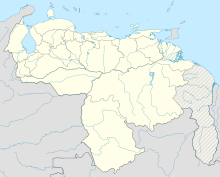
Location of airport in Venezuela
| Direction | Length | Surface | |
|---|---|---|---|
| m | ft | ||
| 11/29 | 1,650 | 5,413 | Asphalt |
Santa Elena de Uairén Airport (Spanish: Aeropuerto de Santa Elena de Uairén) (IATA: SNV, ICAO: SVSE) is an airport serving Santa Elena de Uairén, a city in the Venezuelan state of Bolívar. The runway is 6.5 kilometres (4.0 mi) south of the city, and 6 kilometres (3.7 mi) from the Brazilian border.
The airport was under renovation in 2008[4] and it was re-opened on 29 April 2009 by Venezuelan President Hugo Chavez.
See also
- Transport in Venezuela
- List of airports in Venezuela
References
- ^ Airport information for SVSE[usurped] from DAFIF (effective October 2006)
- ^ Airport information for SNV at Great Circle Mapper. Source: DAFIF (effective October 2006).
- ^ Google Maps - Santa Elena
- ^ "Aeropuerto de Santa Elena listo para su inauguración" (in Spanish). Gobernación del Estado Bolívar. 27 August 2008. Archived from the original on 19 July 2011.
External links
- OurAirports - Santa Elena
- SkyVector - Santa Elena
- OpenStreetMap - Santa Elena
- Accident history for SNV at Aviation Safety Network
- v
- t
- e
Airports in Venezuela
- Caracas
- Acarigua
- Barinas
- Barquisimeto
- Canaima
- Ciudad Guayana
- Cumaná
- El Vigía
- Isla de Coche
- La Fría
- Los Roques
- Maturín
- Mérida
- Punto Fijo
- San Antonio del Táchira
- Santa Elena de Uairén
- Santo Domingo
- Santa Bárbara del Zulia
- Valera
- Anaco
- Cabimas
- Caicara del Orinoco
- Casigua
- Calabozo
- Carora
- Carúpano
- Charallave
- Ciudad Bolívar
- Coro
- Elorza
- Guanare
- Guasdualito
- Guasipati
- Güiria
- Higuerote
- Icabarú
- Kamarata
- La Orchila
- Maracay
- Ocumare del Tuy
- Parai-tepuí
- Puerto Ayacucho
- Puerto Páez
- San Carlos
- San Juan de los Morros
- Puerto Cabello
- Pedernales
- San Cristóbal
- Palmarito
- Santa Bárbara
- San Felipe
- San Fernando de Apure
- San Tomé
- Tucupita
- Tumeremo
- Uonquén
- Valle de la Pascua
 | This Venezuela-related article is a stub. You can help Wikipedia by expanding it. |
- v
- t
- e
 | This article about an airport in Venezuela is a stub. You can help Wikipedia by expanding it. |
- v
- t
- e


