Tridell, Utah
Unincorporated community in the state of Utah, United States
Unincorporated community in Utah, United States
40°27′13″N 109°51′0″W / 40.45361°N 109.85000°W / 40.45361; -109.8500084076
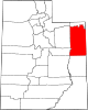
Tridell (originally named Liberty) is an unincorporated community in the Uinta Basin in western Uintah County, Utah, United States.[1]
Description
| Census | Pop. | Note | %± |
|---|---|---|---|
| 1940 | 432 | — | |
| 1950 | 347 | −19.7% | |
| Source: U.S. Census Bureau[2] | |||
The settlement lies along local roads north of State Route 121, approximately 25 miles west of the city of Vernal, the county seat of Uintah County.[3] Until the highway was deleted from the state highway system in 1969, Tridell was the northern terminus for State Route 246. Its elevation is 5,636 feet (1,718 m), and it is located at 40°27′13″N 109°51′0″W / 40.45361°N 109.85000°W / 40.45361; -109.85000 (40.4535682, -109.8498700).[1] Although Tridell is unincorporated, it has had a post office, with the ZIP code of 84076,[4] since 1918. (However, the post office became a rural station in 1964.)[5]
Climate
According to the Köppen Climate Classification system, Tridell has a semi-arid climate, abbreviated "BSk" on climate maps.[6]
See also
 Utah portal
References
- ^ a b c U.S. Geological Survey Geographic Names Information System: Tridell
- ^ "Census of Population and Housing". United States Census Bureau. Retrieved November 7, 2011.
- ^ Rand McNally. The Road Atlas '08. Chicago: Rand McNally, 2008, p. 103.
- ^ Zip Code Lookup
- ^ "Post Offices: Utah, Uintah County". postalhistory.com. Las Vegas, Nevada: Jim Forte. Retrieved June 30, 2020.
- ^ Climate Summary for Tridell, Utah
External links
![]() Media related to Tridell, Utah at Wikimedia Commons
Media related to Tridell, Utah at Wikimedia Commons
- v
- t
- e
Municipalities and communities of Uintah County, Utah, United States
County seat: Vernal
communities
reservation
‡This populated place also has portions in an adjacent county or counties
- Utah portal
- United States portal
Authority control databases | |
|---|---|
| International |
|
| National |
|
 | This article about a location in Utah is a stub. You can help Wikipedia by expanding it. |
- v
- t
- e


